


Program
This characterization study, developed as part of a new urban plan required in the context of municipal mergers, is an urban analysis aimed at highlighting the distinctive features that shape the western and southwestern sectors of Montreal. The study also identifies sites with structuring potential across the territory, which should become focal points in the new urban plan.
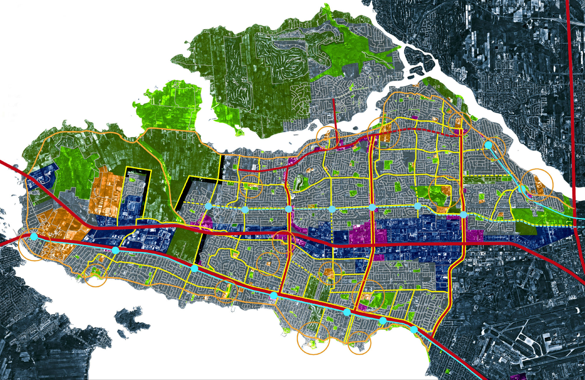
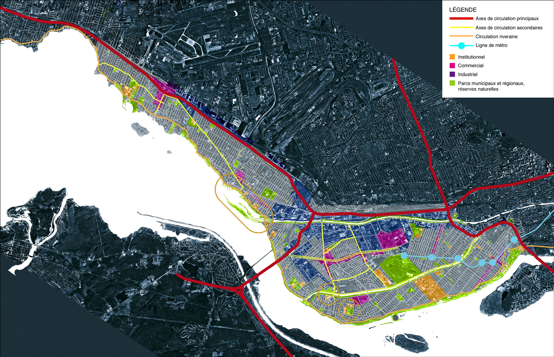
Our reading of the territory is grounded in a historical perspective that links the structural framework of urban conditions in the studied sectors to transportation systems, which have played, and continue to play a major role in the city’s development. We analyzed the constituent elements of the two dominant development cultures forming the framework of the study area: urban and suburban.
Project
We propose sites and projects driven primarily by the preservation of singular elements, the urban and suburban fabric, their adaptability, densification, functional mix, and the strengthening of public transit. Our proposals include: 1° regulatory actions, ensuring adequate protection of village and urban heritage, and transitioning from single-use to mixed-use zoning; and 2° project-based interventions; a mixed suburban network to gradually integrate suburban areas into the urban fabric by superimposing a grid of streets with 1 km by 1 km blocks; new boulevards transforming existing ones to serve a dual function, with central lanes for transportation and lateral service roads acting as neighborhood streets connected to the mixed suburban network; an “Edge City” concept to limit urban sprawl through a defined boundary composed of new buildings, a public roadway, and a linear park, thereby preserving remaining agricultural and natural lands on the island; private megastructures at highway interchanges, introducing large commercial centers at points of highest traffic flow; and a new two-level public transit network, combining a linear system connecting to downtown with a hierarchical grid-based system serving suburban areas north of Highway 40.